Showing posts with label Hiking. Show all posts

Monday, September 7, 2015

A fresh perspective

A change of scenery can do a world of good.

With a busy fall in store and summer fading fast, I was eager to use the Labour Day weekend as an excuse to spend a few days on the trail. Sadly, our three-day mountain trip into Strathcona shifted into a two-day hike before an iffy weather forecast and a load of loose ends around the house convinced my wife and I to stay put.

We stacked some firewood, planted herbs and arugula, picked some weeds, drank tea and cooked up some quinoa-crust pizza. It was a blast and we got loads of crap of the to-do list, but there's only so much domestic life one can take. On Sunday, we decided to ferry over to Vancouver Island for some Indian food and a hike up Maple Mountain in North Cowichan.

Maple Mountain calls to me from across the water every time I climb Mount Erskine. The mountain's diminutive yet thickly forested slopes are hard to miss if you're riding the Howe Sound Queen between Vesuvius and Crofton. Maple Mountain is a tease, too far to warrant a day hike and too close to justify the ferry fare.
But I'd heard good reviews about it and even made it to the neighbourhood on a mutual aid search and rescue mission near the mountain in 2014. I'd hiked some of the park's lower areas in search of a missing man known to walk the trails. The "community forest" has easy access, a wide range of terrain and isn't very crowded. It's easy to see why the mountain draws many people from the Duncan and North Cowichan area. The area is especially popular among mountain bikers, hikers, mushroom pickers and bird watchers.

Garry oak meadow, Maple Mountain

We parked our car at the end of Maple Mountain Road and set off on the Blue Trail. The path skirts under a set of high-voltage power lines before entering the park. I was warned about the smaller, unofficial trails that crisscross across the mountain but discovered that if you stick to the big, colour-coded dots and trail signs, things are pretty straight forward. We only got sidetracked a few times, and it wasn't long before we got back on track. It's a good thing too, since my phone/GPS didn't have much juice left in it.

We reached the junction with the Pink Trail in about 15 minutes. This is a 2.5-hour loop that would take us to the 505-metre  (1,657-foot) summit. The trail hops though rocky outcrops and Garry oak meadows as it rises steadily further from the shoreline. I'd imagined a quick stroll in the woods and dressed accordingly. Cotton shirt and cotton pants, both heavy, hot and drenched in sweat, and we weren't even have way up the mountain yet. Fortunately, the views made up for the wardrobe discomfort.

The east side of Maple Mountain offers some decent vistas of Salt Spring's Burgoyne Bay, Mount Maxwell, Mount Bruce and Mount Erskine. It was fun and mildly disorienting to get an off-island perspective on these familiar peaks. The trail rose into a stand of older growth Douglas fir ringed by thick salal and draped with old man's beard.

At times the trail seemed to go straight up, which isn't a surprise since that's exactly what the map's contour lines show. I hadn't dressed the part and my head space wasn't really in the right gear either. I spent much of the hike up cursing myself for being in such poor shape. At one point I think I may have considered packing it in. Yard work was tiring, but it clearly wasn't nearly enough to keep me in the right kind of shape to stay in the mountain game for long.

View from Maple Mountain to Salt Spring's Mount Maxwell and Burgoyne Bay
The Pink Trail joins an access road about 100 metres from the summit, which is crowned not with a sugar shack but a massive communications tower. We took a moment to sit on on some rocks and enjoy some of  our freshly picked apples while we peered toward Maple Bay under the hum of aerial transmissions.

Summit "sugar shack"
Summit apple
 The northern half of the loop back down the mountain veers off from the access road at some pink flagging in the trees. Walk through the bush and the trail will become clear. Pink Trail north offers a stark contrast to the sunny rock outcrops that punctuate its southern cousin. We sank into deep, dark and wet forest. Aside from a few openings, the trail stays under thick cover of fir and maple trees. Wet leaves underfoot offered a sure sign that fall was near. We happened upon a deer that hopped off into the woods. Moss hung thick as the rocky trail led steadily back to the shoreline, where we reconnected with the Blue Trail, headed south and made our way back to the trailhead.

There was a time when I scoffed at "recommend hiking times." Not today. We made it back to the car within minutes of the 2.5-hour recommendation. We had our dog Goma. We got lost a few times. Too many apples on the summit. We may not have been fast, but at least we're getting good at excuses.

A soggy shirt, gutbusting assent and dead batteries. So much for being prepared. You needn't always travel far to get a different perspective, yet the result can be profound.

Maple Mountain trail map
Reference material:

Guide to Maple Mountain, Municipality of North Cowichan
http://www.northcowichan.bc.ca/files/%7B120C0753-F009-4F6D-954A-311213AECCAA%7Dmaple%20mountain.pdf

Friday, July 10, 2015

Lost and found

Mt. Tom Taylor, July 2015


It always feels funny to strap on a pack loaded with climbing gear and walk on the ferry to Vancouver Island. So many inquisitive looks and recurring queries about my ice axe and snow pickets. Even in winter there are times when fellow passengers bid me good luck in my quest for snow. It’s out there, I assure them; you just have to climb high enough.


Canada Day 2015 proved no exception, but with car loads of families set to enjoy the midweek holiday and the morning sun already burning over a bright blue ocean, it was I who began to ask myself the very questions usually directed my way. 

Ronan, my ride to the hills and tent partner for the coming three days, confirmed the answers when he pulled up to the Crofton ferry terminal in his wife’s immaculate Subaru Outback not too long after all the ferry traffic cleared up. It was mountain time. We’d climbed together years before on a spring trip to Mt. Klitsa, but hadn’t crossed paths in the years since. I’d remembered him as a gregarious Irishman, unafraid to face the elements and explore the wilds of Vancouver Island on his own or as part of a larger group. I was happy to hear he'd begun to spend more time in the mountains after recovering from a tough bout of tachycardia.

We sped north along the island highway in the way so many Vancouver Island mountain trips begin. A left turn at Campbell River towards Gold River and, within an hour, we arrived at Strathcona Park Lodge, our designated meeting spot and an island institution that deserves a blog entry all its own.

I filled my water bladder during the 30 minutes or so that we had to spare until the rest of our group arrived. After all the handshakes and hugs, I was relieved to discover our team had shrunk considerably from the 12 people who’d initially expressed an interests in the trip. Seven was still a larger group than I’m used to but still exponentially more efficient on the trail.

Within an hour we’d driven the length of Buttle Lake, stashed the cars by Bedwell Lake trailhead and shouldered our burdens for the anticipated three-hour hike to camp.

Four kilometres and 500 metres of elevation opens a whole new world. The Bedwell Lake Trail (BLT) is one of Strathcona Park’s showcase features. It’s wide, steady and gives users a more-or-less direct route to the alpine. The only easier way to reach the park’s high country is the Mt. Washington Parkway, but that’s cheating. With its suspension bridges, iron ladders and carefully engineered switchbacks, the BLT is reported to have cost a million dollars to complete. It represents a time when funding was forthcoming and BC Parks were kept to a world-class standard. I doubt any such trail could be built under today's budget.


We hit Baby Bedwell Lake right on schedule, having taken only one major breather amidst a jumble of boulders that featured natural air conditioning flowing out of the rocky vents at our feet. The lake features about a dozen tent pads around a scenic alpine lake. The large granite outcrops that surround the lake offer a spectacular location to pitch a tent, cook a meal, dry off from a swim and soak in the mountain views of Big Interior Peak and Tom Taylor’s east ridge. More than a few members of the group were elated by the site; we’d finally arrived in the mountains.

Sprawled on warm granite under a setting sun, my belly filled with Bombay potatoes, trip leader Andrew called on us to share our goals for the days ahead, share a bit of our personal mountaineering history and offer a confession. He began by telling us he’d forgotten his crampons while transferring gear between cars on the way to the trailhead.

I spoke about a recent trip to Triple Peak, my ongoing battle with tangled rope syndrome and the unfortunate discovery, earlier than evening, of a small tear near the top of my water bladder. I’d applied a temporary patch with cloth medical tape topped with a touch of NuSkin spray-on bandage. I worried about my water supply for summit day and had to spend the first night with a partially soaked sleeping bag.

This post-dinner group summit was a first for me, but one I’d like to incorporate in my future trips. The exchange offers trip participants a chance to get to size each other up, recognize priorities and share concerns. It sounds formal and serious, but we spent much of the process laughing about our forgotten poles and aversion to heights. We agreed to set off at 6 a.m., and I retired to the wet sleeping bag.


In my never-ending quest to minimize weight and declutter those foggy moments between waking up and departure, I’ve taken to eating a Probar for breakfast. These dense prepackaged calories are equivalent to a bowl of oatmeal. Have a second and your hitting logger’s breakfast territory — without the gassy consequences. I’d neglected to confess having forgotten my supply of tea and coffee, but Ronan came to the rescue with a spare java pouch and a touch of Bailey’s to seal the deal. We downsized our packs and hit the trail a few minutes after 6 a.m.

The sun rose quickly as we gained elevation. Within two hours we’d reached a series of sub-alpine tarns that set Roger to dreaming of swims to come along the return journey. The inspiration kept him moving at a strong, steady pace for all 13-hours to follow.

Just past the lakes Ronan discovered he’d left his camera behind during a blister rehab stop a little further down the mountain. Andrew’s crampons and Ronan’s camera were the first in a series of lost objects our group had begun to leave along the trail. The inventory piled up to include water bottles, hiking poles and another camera that Roger left behind after one of the numerous dips he took on the trail back to camp.

The horizon grew to include Mt. Septimus, the Red Pillar, Argus and Mt. Harmston, Nine Peaks, the Golden Hinde, Colonel Foster and Mt. Albert Edward. All of Strathcona’s high peaks were on display. As we got higher, views to the Mackenzie Range, Triple Peak and Clayoquot Sound completed the island tapestry.

The thermometer reached 30 C by noon. We kept up our crawl along the granite ridge overlooking Tom Taylor’s north glacier at an elevation of about 1,700 metres. Summer was in full swing. The soaring temperatures, stunning views and rocky footing conspired to slow our progress.

We spent considerable time contemplating whether to rope up before a snow field only to discover the benign crossing took fewer than 15 minutes. Down a short snow slope, through a notch below the south side of Tom Taylor’s “tooth,” and up a south-facing, sun-baked gully from hell brought the team to the final challenge, an awkward shimmy around a weather-ravaged, old-growth alpine pine growing smack in the centre of a supposed fifth-class move. Another corner, a long reach and a hefty step saw us crest the summit just before 2 p.m. Time for lunch, some photos and a chance to sit back in the sun surrounded by the whole of Vancouver Island. Not a bad place to celebrate Canada Day, even if it was July 2.

We could have spent the rest of the day up there, taking in those views, feeling the great mountain beneath us, yet we were all aware of the long trail back to our camp at Baby Bedwell. We reshimmied past the tree, elected to downclimb rather than rappel and chose to cross low along the upper section of Tom Taylor's north glacier. After a short prussik refresher and rope clinic, our two rope teams shuffled along, taking time to peer into some pretty big gaps and listen to the water rushing through hidden depths beneath snow and ice.


Further down the ridge, we elected to take our chances on what looked to be a shortcut home. The result was about an hour spent retracing our steps after the intended route dissolved beneath some staggering bluffs. Chris and I had chosen a higher route than the rest of the group and were able to cut back up the ridge. This meant negotiating a sketchy scree-strewn gully with a few harrowing hero moves. With my pack growing heavier with each passing step, I cursed finding myself in this situation when the road home had been so clearly laid out before us.

By the time we’d reached camp, most of us were knackered. We’d spread out considerably as the afternoon turned to evening and we each settled into a comfortable pace for the homestretch. A new round of celebration ensued as each member of the group made it back to camp, dropped their dusty clothes and sought immediate relief in Baby Bedwell’s refreshing waters.

A serving of vegetable curry restored my body, and a Purple Jesus revived my spirit as we lay, once again, spread on the warm granite overlooking our alpine paradise. We’d managed to recover everything but the trekking pole and Roger’s point-and-shoot. Given the unfavourable odds of anyone ever finding and returning his camera (and the valued contents of his memory card), Roger was back on the trail at 6:30 the following morning.

While I contemplated the highly utilitarian taste of my second Probar breakfast, a holler screamed down the hillside. By the time I’d packed up, a much-relieved Roger was back at camp with camera in hand. As Ronan and I made our way out towards the trailhead, I swear I could hear the splash of Roger setting out for a final victory swim.

Friday, November 21, 2014

Conquering the Castlecrag Circuit

Time continually twists our perceptions of the past. Looking back, we uncover insecurities, worse writing and great memories. The following is post-dated from an Aug. 2010 hike on the Castlecrag Circuit in Vancouver Island's Strathcona Provincial Park. Earlier this year, I had the chance to revisit the area during a multi-day search for Sylvia Apps and a short weekend trip. The circuit is a wonderful, accessible mountain experience, especially in August (or January!).

Rainy day at Forbidden Plateau (Aug. 2010)
Heavy rain and lingering clouds on Friday afternoon failed to deter hikers from trekking into the wilds of Strathcona Park's Forbidden Plateau on the last weekend of August.

At the trailhead, returning day trippers had reports of hail and sleet and snow at various points throughout the day. Nice to finally see some weather after nothing but blue skies and sunshine for so many weeks on the south coast.

Summer is so overrated.

I longed for the high temps and sunscreen after getting thoroughly drenched about 30 minutes into the eight-kilometre hike to Circlet Lake. Aside from my lousy rain jacket, the walk into Circlet is a breeze with very little elevation gain and plenty of dramatic vistas to start the trip on the right foot.

About a kilometre from our destination for the night, a BC Parks ranger bounded up the trail to tell us the Circlet Lake campsite was overflowing with people.

"There are even all sorts of kids and dogs there," he said.

Based his caution, the group reversed course and took the turn off to a deserted Kwai Lake Campground. The sun came out, and it was good times for all.

Camping at Kwai put plans for the Castlecrag Circuit in jeopardy. The detour added about seven kilometres to our original plan. After a good meal, we decided our group of 10 would split into two groups. One would take a slower pace and enjoy the out-and-back journey to Mt. Albert Edward while the second opted to make time and rise early for a pre-dawn start.
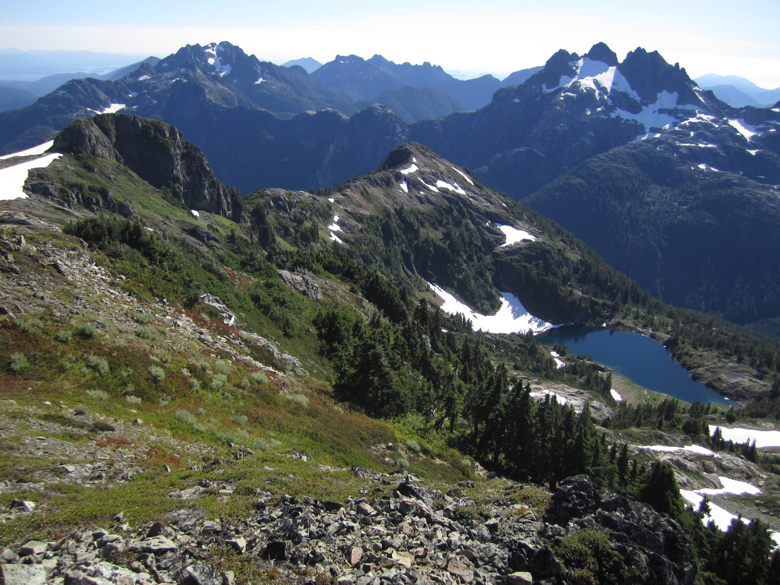
It took our group of four about 4 1/2 hours to reach the summit of Castlecrag Mountain (1,740 m / 5,709 ft). The ascent involved a wonderful sunrise over the east coast of Vancouver Island as we ascended a relatively easy and well-marked route into some awesome alpine scenery.

North aspect of Mt. George V, with flowers
Castlecrag's northern aspect presents itself as an impenetrable fortress, forcing all but the bravest of climbers to circle the mountain and access the peak via the south. A quick scramble off the main route to the summit revealed some stellar views of Strathcona Park from this slightly off-the-beaten-path peak.

Scree slope off east side of Castlecrag Mt.
From the summit, the second of the day's three peaks looming in the west. Whereas Castlecrag demands a swift assault, Mount Frink (1,948 m / 6,391 ft) requires a steady and deceptively long ridge slog. It only took our group about 90 minutes to navigate our way up Frink's mostly barren and snow-free eastern slope, though the number of false summits on our way up quickly went beyond humour.

A pepperoni and cheese summit lunch was followed by a well-deserved ride down several hundred metres of snowfields into a col en route to Albert Edward (2,093 m / 6,867 ft). From there it was another steady slog up the slope to more views and the next peak.

Breathe, smile, enjoy.
On Vancouver Island, 2,000M is a big deal!
It was great to finally get above 2,000 metres and enjoy some of the great alpine country that Vancouver Island has to offer after a summer I'd spent in marathon mode and messing about in boats.


Northeast aspect of Mt. Albert-Edward (left) and Mt. Regan (right)
There were loads of people crawling all over the summit and we saw many folks hiking up quite late in the day. Seemed like a last-ditch effort to make the peak before the autumn rains and snow bring an end to the hiking season.

The hike out proceeded down a nasty, steep trail along slick clay and, eventually, out onto the main trail to Kwai Lake.

Total time from tent to tent was a few minute over 12 hours. Conditions couldn't have been better and there was little snow along the route. Basing out of Kwai allowed us to travel fast and light throughout the day. The ideal weather conditions made it almost too easy, though I was out cold within minutes of hitting my Thermarest at 8 p.m.

Day three was a sleep in and quick two-hour hike past the humble Mt. Elma and out to the parking lot, where we whisked ourselves to the lunch buffet and cold beverages on offer at the base of nearby Mount Washington.

Rarely gets any better than this.

The original version of this trip report was published on Club Tread.

Sunday, August 24, 2014

Hiking with Goma: Kwai Lake


Kwai Lake at dawn (August 17, 2014)
I used to climb mountains; now I walk a dog.

My newest hiking partner is a four-month old black lab-border collie cross named Goma.

Goma wakes up early, usually just before sunrise. This is great on a trip like this, when the mornings are dry and warm.

We usually walk to the end of the driveway, a dusty dirt track that stretches for about 200 metres. On more adventurous mornings, we make it past the mailbox and down the road. We've gone on a few of nearby hikes but never tried anything as adventurous as a 15-kilometre roundtrip overnighter.

Hiking with Goma means more breaks than usual
I had read that it's important to keep trips shorts for young, growing dogs. Their bones and joints are sensitive and liable to damage with too much exertion. Dogs also aim to please and have a problem deciding when to pack it in.

Warnings in mind, I decided a relatively flat hike into Kwai Lake in Strathcona Park would be the perfect venue to introduce Goma to the mountains. It felt like a compromise; we would stop short of Circlet Lake and well below Mt. Albert-Edward, but still get beyond the range of the day tripping crowd.


The service road to the Mt. Washington ski resort provides convenient year-round access to one of Vancouver Island's finest alpine areas. Cars and trucks filled the sprawling parking lot outside the Raven Lodge nordic centre, which appeared closed for a private function that involved no participants. It was already late in the day, but we spotted several folks changing into their mountain clothes, tightening boot laces and adjusting packs by their vehicles.

I took the busy parking lot as a bad omen. Here we were, midday on a sunny, summer Saturday, heading into one of the most accessible backpacking areas on the island. I felt our chances of finding a decent camp spot that evening were dismal at best..

The first 2.5 kilometres follows part of the Paradise Meadows loop trail. This fully boardwalked section offers novice hikers an appetizing taste of the mountain environment. Little signs alongside the trail point out mountain heather and hemlock trees. There are mountain lakes and picturesque meadows that overflow with alpine flowers if you time things right. Come winter, the area can buried under up to seven metres of snow, making it an ideal place for backcountry skiing, snowshoeing and winter camping.

We left the Paradise Meadows loop at the junction to Battleship Lake. That was it for the boardwalk and the traffic level decreased considerably. We reached the junction to Lake Helen Mackenzie in a little more than an hour. Our backup plan was to camp here, but it was still relatively early in the afternoon and we were just finding our hiking legs. We'd taken a few short rest stops and water breaks and covered about half the distance to Kwai Lake. Goma looked like he could easily handle another four kilometre so we voted to push on.

Since dogs need to be leashed in provincial parks (especially on heavily trafficked boardwalk areas), Goma spent much of the first couple of kilometres pulling ahead. When we took him off leash he ran forward, turned around and return to us slackers. He did this over and over again. In the first hour, he surely covered twice our distance and expended significantly more energy because of his frenetic hiking style.

It was time for a nap by the time we were halfway between Lady Lake and Croteau Lake. We found a comfy spot amidst a blueberry patch and, within minutes, the dog was in dreamland. A father and daughter team who stopped to chat said they were one of only two tents at Helen Mackenzie. They were on a mission to reach Kwai Lake and return to their camp in time for dinner with mom. They still found some time for a berry break and a chat. Whether it's at the dog park, waiting outside the grocery store or sitting alongside a mountain trail, dogs are great conversation starters.

August means blueberries abound in much of Strathcona Park
I wonder if we could have completed the final two-kilometre slog to Kwai Lake without the handful of blueberries that kept our animal in action. Every dose supplied a burst of energy, which he unwisely used to run circles around us. By the time we reached camp, Goma figured out how to eliminate the middle man by picking his own berries.

There were only three tents pitched when we arrived at Kwai. We canvassed the area and discovered that the lake's prime waterfront site was, incredibly, still available. We set up camp and took in the lakefront view, though clouds obscured the distant peaks. The campsite at Kwai has an outhouse and bear locker, not too bad a deal for $10/person. Two other couples arrived later in the afternoon and there were still many decent spots left to choose from. My worries about campsite overcrowding were, once again, unfounded.

Getting comfortable in camp
We dined on a multicourse meal of rice crackers, Thai noodles, Indian curry rice and chocolate, accompanied by the finest of boxed French wines. I'm getting sick of my curry meals, but they're so easy and packable. The wine, on the other hand, wasn't too bad.

Goma took a while to get comfortable. I think it was the combination of exhaustion, uncertainty and mosquitoes. He was very defensive and alert to every sound, but could barely keep his head steady. After we turned in, I spent much of the night wondering if it was time for a bigger tent.

With the exception of a mountain trip or need to catch a ferry or flight, I never used to wake up this early. Goma likes to wake everyone up at dawn, sometimes earlier. He eats breakfast at 6 o'clock (not sure who established that one!) and we usually take a short walk down the driveway or around the neighbourhood before seven.

Morning on Kwai Lake
Goma's sleeping habits got me out of the tent in time to watch the sunrise as we walked and explored around the lake. We met two guys in their sixties that were off early to climb Albert-Edward, a hefty 16-kilometre roundtrip that awaits Goma in a year or two.

After some breakfast gruel and a cup of tea, we were packed up and on the trail by a few minutes after 10 o'clock. Goma appeared to have learned a thing or two about pacing, which made the trip out much easier, until he eventually collapsed a few hours later in the shade by a water bucket placed outside the Strathcona Park Wilderness Institute kiosk by the trailhead.

Hiking out of the Kwai Lake campsite
We returned via the Brooks-Elma pass, rounded Lake Helen Mackenzie and chilled lakeside (swimming and more Thai noodles) near the day-use area for at least an hour. Since it offers the most direct access to the popular Circlet Lake camp and the high country beyond, we met a lot more people on the outbound trail. By the time we were at the lake we were back in day-tripper land.

Friday, July 11, 2014

'A stupendous mass of rock'

It's hard to miss Mt. Arrowsmith; the peak and its surrounding massif stands out in a mantle of snow for much of the year, offering an impressive sight for anyone driving along the island highway.

Mt. Arrowsmith was one of the first mountains I climbed after moving to the region nearly 10 years ago - cannot believe how time has flown by. Having settled from the province of Quebec, I recall being amazed at the trail's steepness and the massive trees that manage to thrive along the slope..

I've since climbed the Judge's Route with friends from "back east" who express the same amazement at the trail's intensity.

"Ma t'en calisser une," as we say in La Belle Province.

Judge's Route, Mt. Arrowsmith, May 2014
After hiking elsewhere on the West Coast, I discovered Arrowsmith's steepness is pretty much the status quo for island peaks, which confidently strike skyward out of the Pacific Ocean.

I've climbed the peak half a dozen times now, mostly on the popular Judge's Route. The latest trip, in May 2014, took about six hours. Tempearatures in the valley below were well into the twenties - quite hot for May in these parts - and the sizzling, sunny weather followed us to the summit, yet there were still some pretty expansive snowy patches along the way.

"A steep, formidable climb when viewed from below, it is in fact a very aesthetic line which does not require technical skills," writes Lindsay Elms of the JR in his chapter devoted to the mountain in Beyond Nootka.

Judge's Route, Mt. Arrowsmith, May 2014
Arrowsmith offers a range of climbs for all skill levels, including the Unjudge's Route, Lost Gully and the dizzying Nose routes. Whatever path you choose, the mountain is sure to offer a challenging mountain experience in every season.

Despite an elevation of only 1,817m (5,962 ft), Arrowsmith looms large in the history of Vancouver Island mountain life. The earliest recorded ascent was an apparently thirst-quenching slog from the nearest road access that entailed a river crossing, porters and an overnight near the ridge. Back then the mountain lacked the easy access offered by the logging roads that now dissect the area.

"The next morning we were up at daylight and went about two miles climbing over the ridge of the mountain and up to the main peak - a stupendous mass of rock, about as big as 10 St. Paul's Cathedrals," wrote Dr. James Fletcher of his 1901 ascent.

In the late 1800s, many mountain folk thought Arrowsmith had to be Vancouver Island's  highest point. There was clearly much they hadn't seen, but the peak still stands as a stupendous mass that can inspire and challenge alpinists of all abilities.
Summit platform, Mt. Arrowsmith, May 2014

Reference:

Elms, Lindsay,  Beyond Nootka: A Historical Perspective of Vancouver Island Mountains: Misthorn Press, 1996.

Thursday, February 7, 2013

The local hill: a walk up Mt. Erskine

Everyone should have a local mountain, a place that looms large in a person's everyday physical and psychological landscape. The mountain need not be climbed on a regular basis or ever at all. It doesn't have to be especially challenging and can have offer a variety of methods to reach the top. Come to think of it, a local mountain doesn't even really have to be a mountain at all, any old hill can suffice quite nicely. What's important is the mountain's ability to inspire the imaginations and the wonder of those who live in its shadow. It's prominence can inspire, it's presence can reassure and, if all else fails, it can always be a great spot to spend a Saturday afternoon.
 
The view from the top can offer an inspiring view at any time of year.
Salt Spring Island offers a handful of local-mountain contenders. Mine is Mt. Erskine, a rocky outcrop that overlooks a good stretch of the island's eastern shoreline, some Gulf Islands to the north and the busy little pulp mill town of Crofton, B.C.


I can usually spot the summit on my way to work on all but the foggiest or darkest of mornings and it's elevation of a mere 410 metres (1,345-feet) always plays the temptress. It's common to see people head up one of the two trails to the summit during lunch or after work, even in winter when the rain and early nightfall do their best to keep people near a warm pot of tea and a comforting wood stove.

Foggy scene on the way to the summit.

My preferred route is the Jack Fisher Trail, accessed across the street from a small pullout along Collins Road. At times, it's tough slog, but the trail is easy enough to follow and a little persistence can get most people to the top in an hour or so. When in doubt, keep heading uphill and the trail will eventually spit you out at a rocky summit where a comfy wooden bench and stone-carved dog bowl reward two- and four-footed hikers alike. There's also a log book amidst the rocks for anyone inspired to mark their visit in prose.

Despite its consistent presence in my daily viewscape, Mt. Erskine offers an ever-changing display of people and scenery over the course of the year. You can meet everyone from the athletically inclined who are after new personal speed records to folks out for a casual walk, alone or with friends. I've even run into a couple of people over the years who've climbed the mountain in their bare feet.

Perhaps they'd learned a thing or two from those elusive Erskine fairies.

Friday, September 21, 2012

Sick day: Midweek foray to 50-40 Peak

With a sunny and hot high pressure system permanently parked over much of Vancouver Island this month, it was only a matter of time before something was going to give. In my case, an invitation to hike 50-40 Peak from a local hiking group was simply too great an opportunity to pass up, even if it meant a ditching an already understaffed office on a Thursday. Some days are just too nice to spend inside. Besides, I really was in need of a little something the Japanese call shinrin-yoku.


 Forest bathing, as it's translated in English, basically involves visiting a forest for relaxation and recreation. The bathing component refers to the human body's supposed immersion in a wealth of atmospheric substances emitted by trees and foliage known as phytoncides.

Apparently, the effects of bathing in the forest air showed some positive effects in enough studies that, in the early eighties, the Forest Agency of Japan recommended regular jaunts through the forest as an important part of a healthy lifestyle. Since then, it's become a recognized relaxation and/or stress management activity in Japan and other parts of the world.

Breaking through the treeline.
Even though people in Canada have been hanging out in the woods for all sorts of worthwhile reasons since day one, shinrin-yoku made the headlines when it was featured in the Globe and Mail newspaper in May 2012.


The lower slopes 50-40 Peak's Cobalt Lake Route, accessed at the 10-kilometre mark of Marion Mainline off Highway 4, offered some ideal forest bathing terrain. After a quick skip along a steep and steady  huckleberry-lined trail through teen-aged second-growth forest, the trail sides a creek that runs through an impressive stand of towering yellow cedars and hemlocks. Don't let summit fever prevent you from taking a moment to breathe in those phytoncides.

The big timber eventually gives way to sub-alpine vegetation and the occasional rocky outcrop with great views across the valley to Cat's Ears, Triple Peak, Pogo Peak the Pacific Ocean and countless other Vancouver Island high points.


Attainable in only 90 minutes at a comfortable pace, Cobalt Lake is a worthwhile goal in its own right. Great views, a comfortable lunch spot and a chance to play in the September snow. Only complaint was the bugs who realized we'd arrived in the neighbourhood. by the time I'd unwrapped my sandwich.

Cobalt Lake in September.
Above Cobalt Lake, the trail climbs through a last thicket of forest to reach a wonderful ridge with more great views towards the mountains of Strathcona Park and beyond. Form here it was a matter of negotiating our way through a series of small scree fields and gullies to the summit ridge. The trail isn't always obvious, but a good look around should get you back on track. On the way down, we got sucked down a narrow and steep gully that required plenty of root swinging between footholds. The terrain above Cobalt offers something a little more than any old walk in the woods and the alpine flower show made it especially worthwhile.


The views from the top are spectacular but bright sunshine and temperatures easily approaching 30C on the summit ridge, it wasn't long before I found myself wishing for another dose of shinrin-yoku in the cool moist forest below.

Nootka Lupine


Saturday, June 16, 2012

Celebrating spring on Klitsa Mountain's north ridge

Thirty minutes to the west of Port Alberni begins a thick tangle of steep-sided peaks that channel Highway 4 to the open Pacific. Most see only a trickle of climbers throughout the season but a contingent of local mountain folk have charted several routes up the most prominent peaks.

Avalanche runout at the base of Klitsa Mountain's north aspect

Among those is the 1,639-metre (5,377-foot) Klitsa Mountain, whose summit and north ridge dominates the south west skyline as one drives along Sproat Lake. To the Hupacasath First Nation, the mountain has traditionally been called Kleetsa because of the white chalky appearance it maintains for most of the year. During an early June foray to the summit along the mountain's north ridge, the name didn't fail to disappoint.

Descending Klitsa's Great Gully

 Although closer than many of Vancouver Island's more well-known peaks, the area's many overlooked summits are still a pretty long trek for most south island resident. Throw in the need to catch a ferry over from Salt Spring Island and the benefits of overnight near the trail head become significant — even with 14-hours of daylight.

Our party of eight elected to camp out in a clearing along the Taylor River main logging road which traces the banks of the swift-flowing Taylor River. The head start gave us ample time to enjoy our surprisingly scenic "campsite"before hitting the trail at about 8 o'clock.

We travelled several hundred metres up a logging spur until the deteriorating road finally gave out at a washout. Although it had previously been possible to drive along much of the spur until the trailhead proper, it appears those days won't return anytime soon. To add insult to injury, it seems part of the forgotten spur suffered some pretty hefty avalanche damage.

After about a 45-minute stroll, the trail takes a sharp right and begins to climb alongside a stream through a picturesque old-growth hemlock forest. Some in our group spoke of rumours the area might be logged in the near future, an unfortunate prospect indeed.

The trail reaches the base of a gigantic north facing bowl. A chaotic scene of uprooted trees proved this is no place to hang around in avalanche season. With crampons cinched and harnesses secure just in case, our route followed a semi-steep narrow gully up hiker's left to the North ridge proper. Rain turned to sleet and sleet turned to rain as we crested the ridge and sat down for a well-deserved lunch.

Even in June, the ridge carried some impressive cornices but the snow conditions were ideal as our crew kicked steps towards the summit block. With only a few hundred metres to go, four of our party veered to the east to ascend the final summit block by way of a cozy looking gully that shot its way up the mountain's north eastern aspect.

Ascending Klitsa Mountain's north ridge
Reaching the clouds along Klitsa's north ridge
Towards the Jubilee Gully

The phenomenal views we'd come to take in were nowhere to be seen when we reached the top shortly after 2 p.m. It wasn't until we were preparing to make our descent via the Great Gully that the sun finally burned through the clouds and lit up the massive bowl at our feet. A welcome glissade/butt slide got us to the treeline double quick for the easy ramble back to our vehicles below
 
Down the Great Gully
For more pictures click here